
Sponsored
Nairobi, Nairobi Central, 1 hour ago
13 views
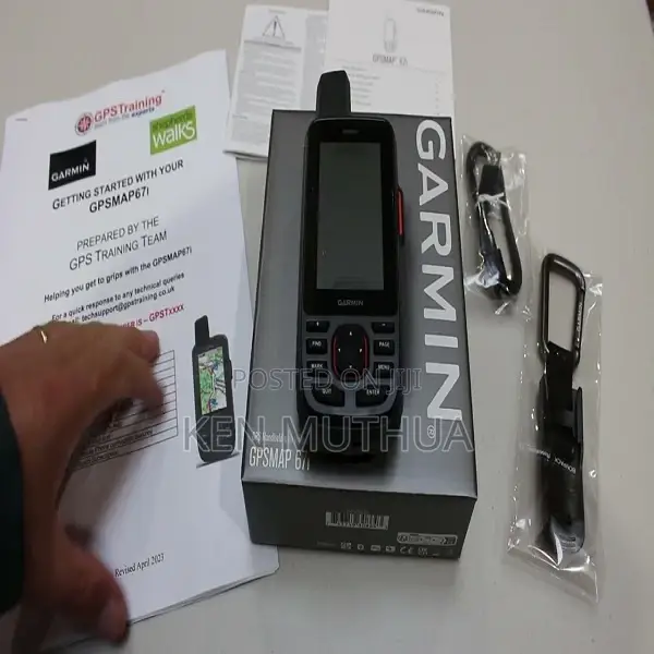
Garmin Gpsmap 67i
Garmin
Brand
GPS Devices
Type
Brand New
Condition
Access multiple global navigation satellite systems (GPS, Galileo and QZSS). Get access to multiple frequencies sent by navigation satellites for improved position accuracy in areas where GNSS signals are reflected, weak or typically don’t penetrate.
Navigate every trail with ABC sensors, including an altimeter for elevation data, barometer to monitor weather and 3-axis electronic compass.
Download high-resolution photorealistic maps directly to your device via Wi-Fi technology. Easily find trails, pick stand locations and parking, create waypoints and more.
Preloaded TopoActive Europe maps show you summits, parks, coastlines, rivers, lakes and geographical points.
With an Outdoor Maps+ subscription, you get public land information, landowner names, state plat maps, BLM boundaries and more. (USA Only
Safety tips
- Avoid paying in advance, even for delivery
- Meet with the seller at a safe public place
- Inspect the item and ensure it's exactly what you want
- Make sure that the packed item is the one you've inspected
- Only pay if you're satisfied


